|
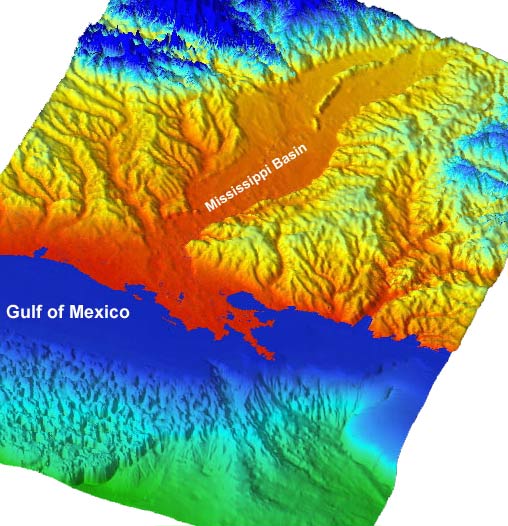
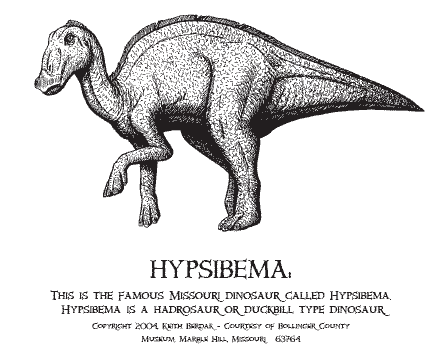
Dinosaur was trapped in a quake fault south of Marble Hill, WSW of Cape Girardeau. See topography Hypsibema missouriense model at Bollinger County Mo Natural History Museum, Marble Hill
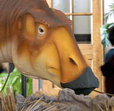
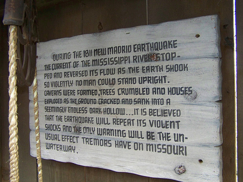
at Silver Dollar City, Branson Mo
|
|
|
|
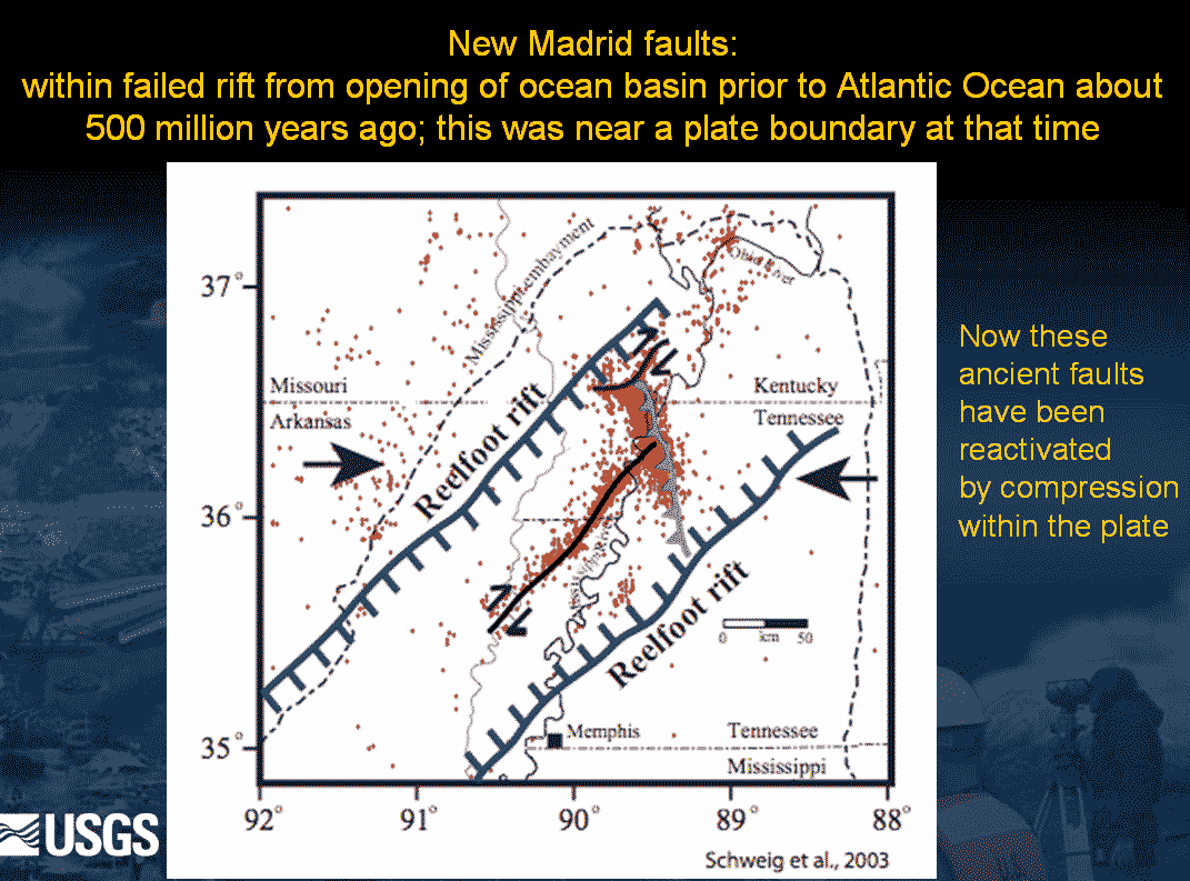
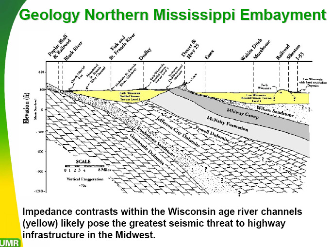
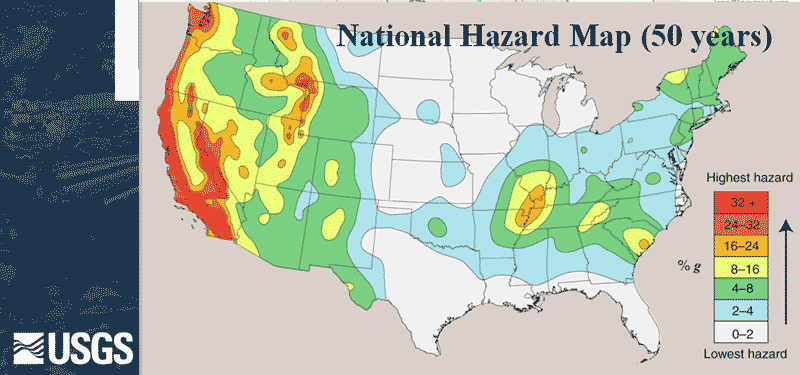
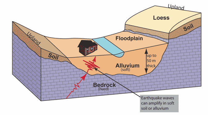
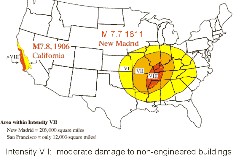
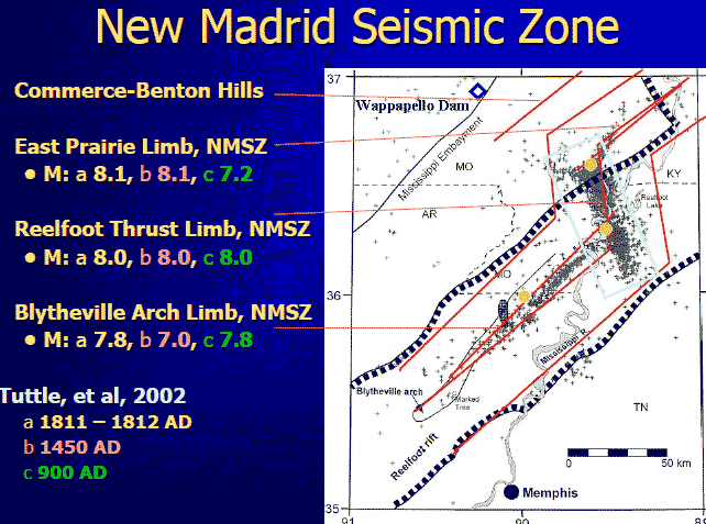
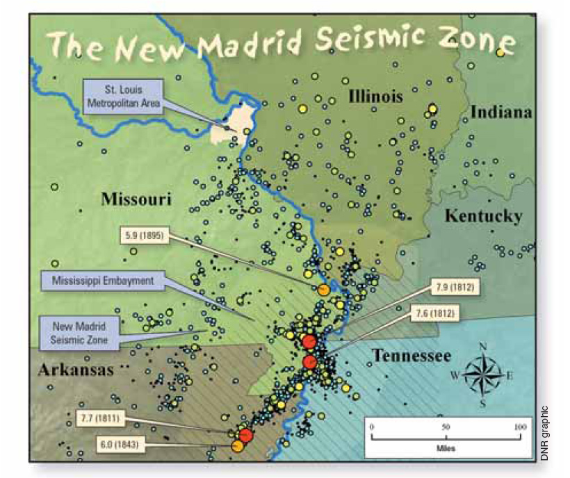
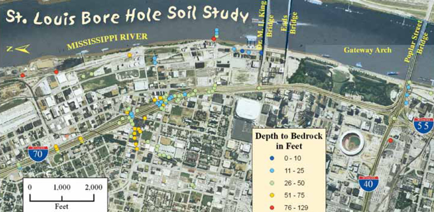
MO DNR article on seismic mapping. Bedrock in downtown St. Louis is 10-100 feet below ground, which leaves little room for liquefaction, amplification during a quake. A corresponding area of downtown Memphis would be 3,000 feet above bedrock. See Mississippi Embayment references in topography and origins on this site. MO DNR graphics.
|

|
These graphics can be expanded. Right-click, SAVE AS, then open them on your computer.
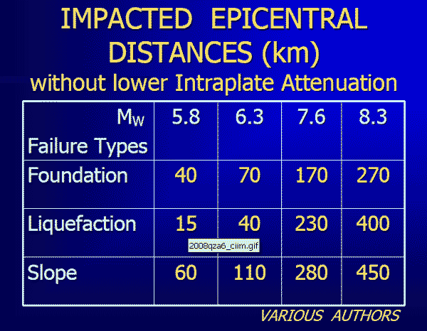
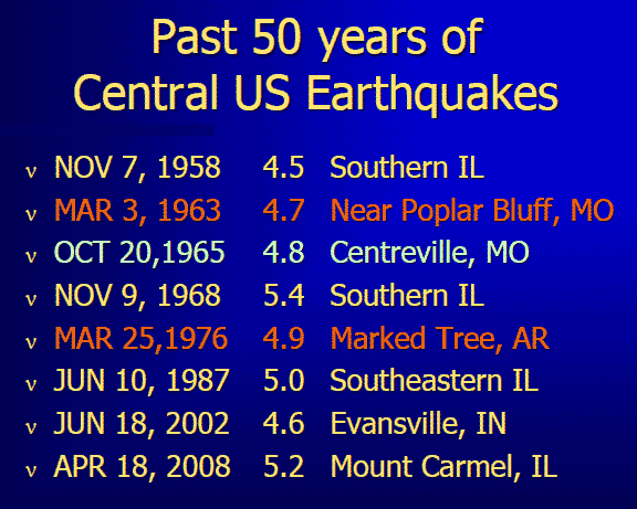
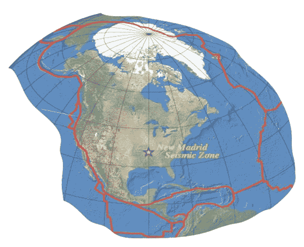
above 3 graphics from J. David Rodgers, mst.edu
Map pages 1 | 2 | 3 | 4 | 5 | 6 | 7 | aerials | sitemap
Powered by ShowMe-Net
|