Moderate/Large Earthquakes, intensities in the Central United States
1811-12 New Madrid XII. | 1838 Southern Illinois widespread VI | Aug 17, 1865 New Madrid Fault VII | Oct 31, 1895 Charleston MO VIII | 1891 Wabash Valley fault VI | 1917 St. Francois uplift | Marked Tree AR VI 1976 | Sept 26, 1990 Chaffee New Hamburg MO |
from http://www.sema.dps.mo.gov
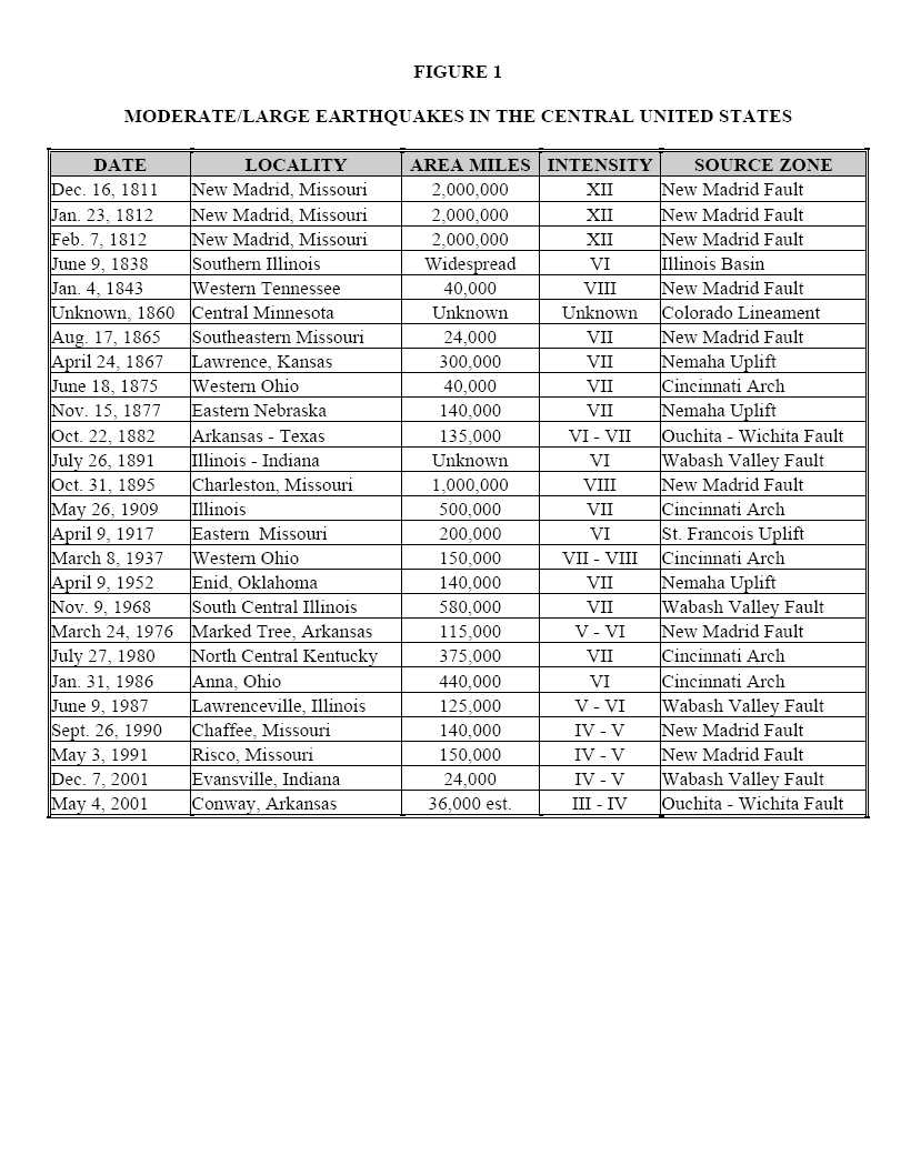
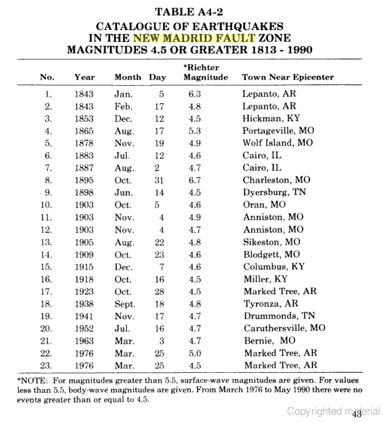
two tables above are from Otto Nuttli book Effects of Earthquakes in the Central US.
The duration can be from a few seconds up to 5 minutes. The period of tremors (and shocks) can last up to several months. The larger shocks can cause ground failure, landslides, liquefaction, uplifts, and sand blows.
The earth's crust is made up of gigantic plates, commonly referred to as tectonic plates. These plates form what is know as the lithosphere, which varies in thickness from 6.5 miles (beneath oceans) to 40 miles (beneath mountain ranges), and has an average thickness of 20 miles. These plates "float" over a partly melted layer of crust called the asthenosphere. The plates are in motion, and areas where one plate joins another are referred to as “plate boundaries.”
Areas where the plates are moving toward each other are called convergent plate boundaries, and areas when they are moving away from each other are called divergent plate boundaries. The San Andreas Fault in California is a horizontal motion boundary, where the Pacific plate is moving to the north while the North American plate is moving to the west.
These movements release built-up energy in the form of earthquakes, tremors, and volcanic activity. Fault lines such as the San Andreas come all the way to the surface and can be readily seen and identified. Some fault lines do not come all the way to the surface, yet they can store and release energy when they move.
Many of the faults in the central United States are characterized this way. The subterranean faults were formed many millions of years ago on or near the surface of the earth. Subsequent to that time, these ancient faults subsided, while the adjacent areas were pushed up. As this fault zone (also known as a rift) lowered, sediments filled in the lower areas.
Under pressure, sediments hardened into limestones, sandstones, and shales, thus burying the rifts. With the pressure on the North Atlantic ridge affecting the eastern side of the North American plate, and the movements along the San Andreas Fault by the Pacific plate, the buried rift system, in the Mississippi embayment has been reactivated. This particular rift system is now called the Reelfoot Rift.
Eight earthquake source zones are located in the central United States, two of which are located within the State of Missouri. The most active zone is the New Madrid Fault, which runs from northern Arkansas through southeast Missouri and western Tennessee and Kentucky to the Illinois side of the Ohio River Valley. Other zones, because of their close proximity, also affect Missourians. These are the Wabash Valley Fault, Illinois Basin, and the Nemaha Uplift.
The Nemaha Uplift is of concern to Missourians because it runs parallel to the Missouri/Kansas border from Lincoln, Nebraska, to Oklahoma City, Oklahoma. Earthquakes from the Nemaha Uplift are not as severe as those associated with the historic New Madrid fault zone.
Powered by ShowMe-Net