Haiti 7.0 quake Jan 12, 2010
What can we learn from it?
People in low-lying "riverbottom" land will feel a quake more, and see more
damage than those on the hills. J. David Rogers of mst.edu says such low-lying
land will amplify the shake 600%. See the white arrow in map below, pointing to
a "natural depression" which is Port au Prince, Haiti. The small neck of land is
not much above sea level, while the rest of the country is several hundred feet
to even several thousand feet.
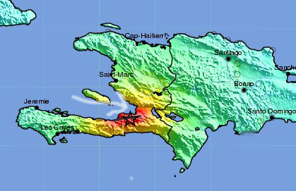
Above: USGS shakemap. Red is strongest quake intensity. White arrow points to
a "natural depression" - Port au Prince with high population density and poor
housing construction.
The starred quake epicenter is 15 miles away, and 600 feet higher.
Below: Google earth view of the same. The whitish area is Port
Au Prince. Epicenter, in the hills, is noted as "M 7.0".
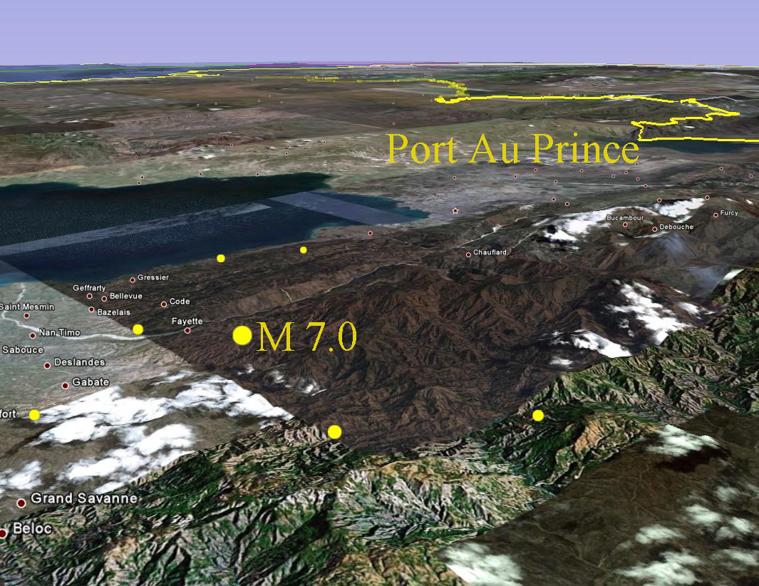
Google Earth image
The 1989 Loma Prieta California quake epicenter was in the hills 63 miles
away from the tourist-popular San Francisco Marina district. Yet we heard almost
nothing of how the quake affected the hills.
The Marina district of San Francisco was massive sand dunes before
settlement, and then filled with earthquake rubble 100 years ago. News reports
forget to mention that poor construction on poor soil foundations makes the shaking effects much worse.
Find Charleston and East Prairie, both
in Mississippi County, Missouri. The
eastern half of Mississippi County is also low-lying, and it's about the same land
area as Port au Prince.
Visualize dropping three million people into the low, flat eastern half of
Mississippi County, Missouri, in poorly constructed multi-story dwellings. Some of the parallels may not hold, but you get the main
idea: quake planning is a good idea, and is expensive.
Haiti (left part of the island) is the size of Maryland, and has 9 million people.
Maryland's population is 6 million. One-third of the Haiti population live in the small neck of land where the arrow points (7 by 20 miles).
Baltimore without suburbs is about 10 x 10 miles, and has 600,000 people.
Wikipedia says
Chicago has 12,000 people per square mile
Baltimore 8,000 per square mile
Miami 6,000 per square mile
Port au Prince 73,000 per square mile
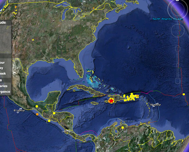
Quakes occur frequently 200-300 miles further east, around Puerto Rico. Yellow quakes occurred in prior week.
The multicolored line just north is where two tectonic plates come together.
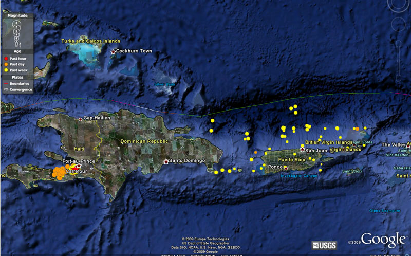
Google Earth gives graphic depiction of the ocean floor. Several 4.0-5.0 aftershocks occurred, shown in dark orange.
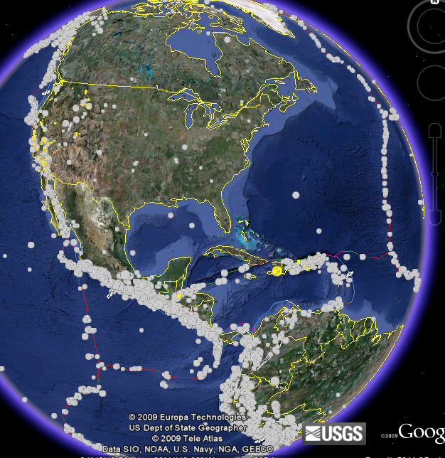
The white dots are quakes of the last 40 years, above magnitude 3.0. Note the border in mid-Atlantic.
The expansion and contraction of this border of tectonic plates a few hundred-million years ago,
pushed and pulled on the New Madrid area, creating weakness.
These views tend to make the New Madrid area look harmless. Keep in mind that the effect
of quakes represented by these dots does not travel too far. The New Madrid region, not near any of the multi-colored
tectonic plate lines, can resonate the entire continent like a big bass drum
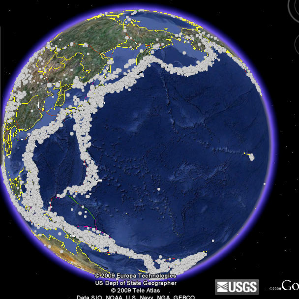
White dots in Pacific show part of the "ring of fire" along edges of tectonic plates.
http://neic.usgs.gov/neis/bulletin/neic_rja6_h.html
- more maps on major subduction zones and tectonic boundaries of Haiti area.
The country is spelled "Haiti". The Missouri Bootheel town of Hayti (with a Y, pronounced HAY-TIGH) will heavily feel a heavy New Madrid area shake.
On a typical weekday, with no real news mention of earthquakes, this website gets roughly 200 visitors. The Jan 12 count was 2,000 visitors that day, and 6,000 the next.
A few days later, the count reached 16,000 visitors. People are interested.
Disclaimer: We do not claim to have quake expertise. We do claim to try to be fair, balanced and accurate in what we say.
Index
Powered by Show-Me.net
|